3d GPS Machine Control
leica icon 3d control box coopergeomatics

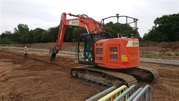
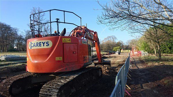
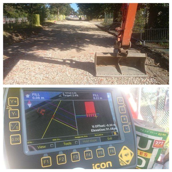
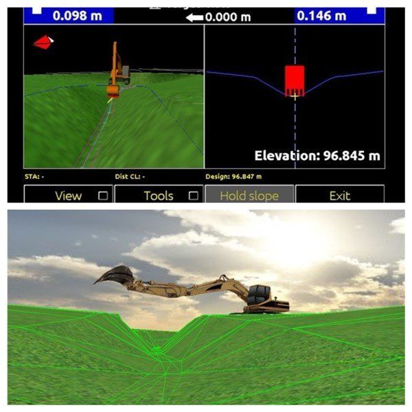
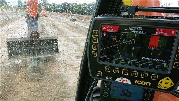
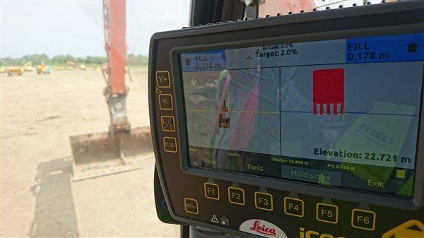
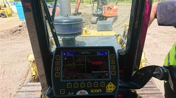
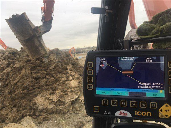
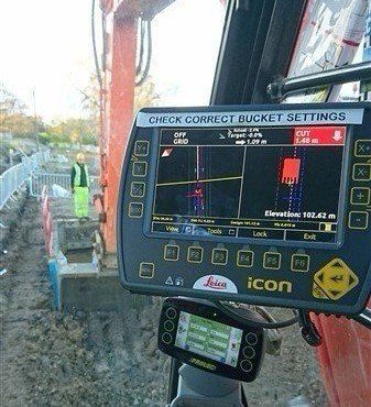
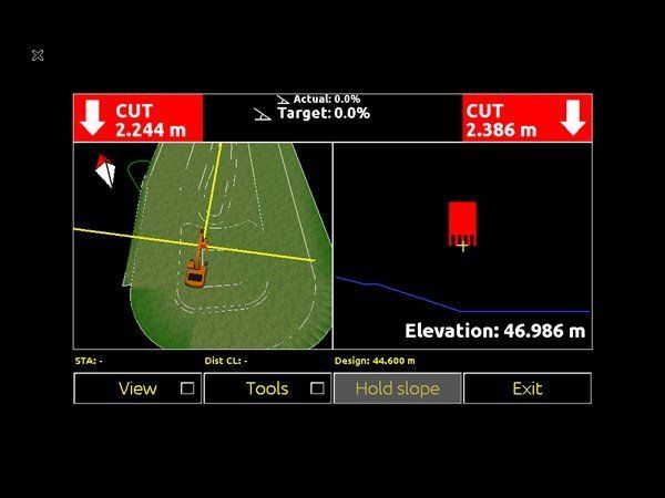
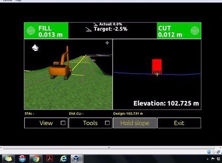
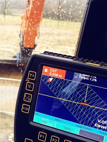
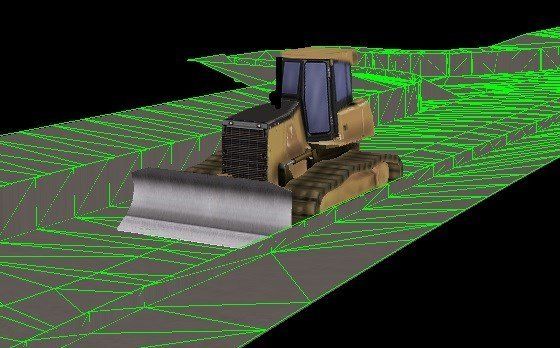
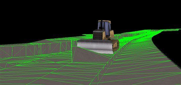
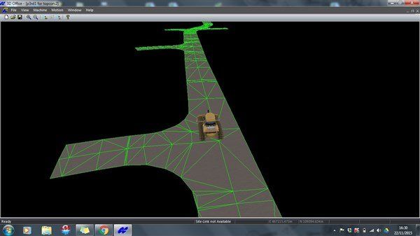
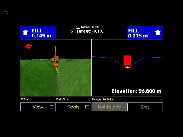
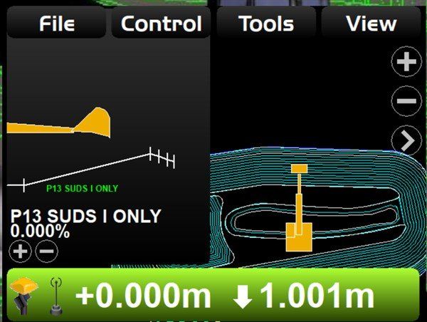
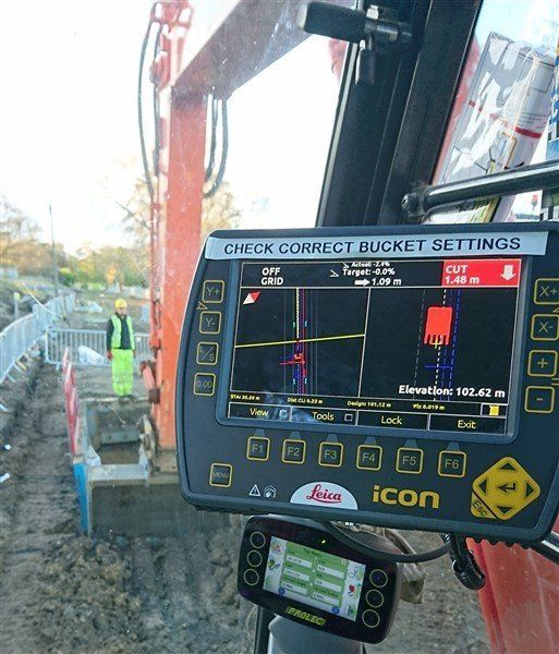
I can prepare files for Leica and Topcon machine control and upload to the system in the operators cab. I can create files for Trimble systems but am not yet able to simulate before uploading. I have experience of creating the models and seeing them work on the control box. By using a combination of LSS, autocad, the Leica Icon Emulator and Topcon 3d office / 3dmc simulator I can create, amend and most importantly, check the integrity of the model and files and remove any anomalies. I work with the machine operator to create layers and colours that suit his / her preference. If they want the centre line pink and the channels yellow then so be it! Ultimately it is the operator who is key to getting the best out of the system.


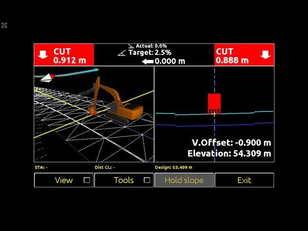
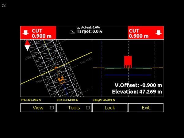
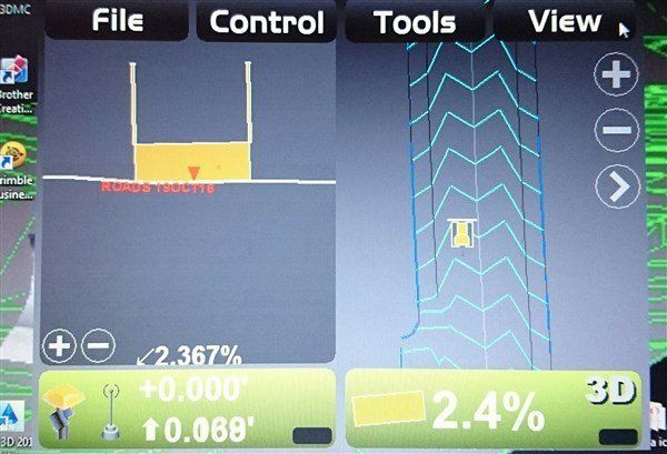
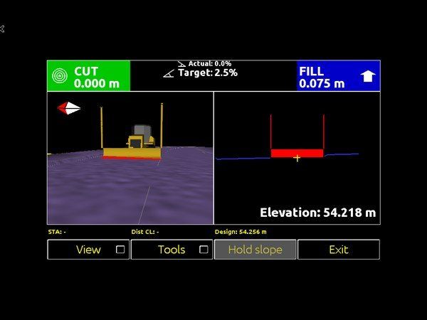
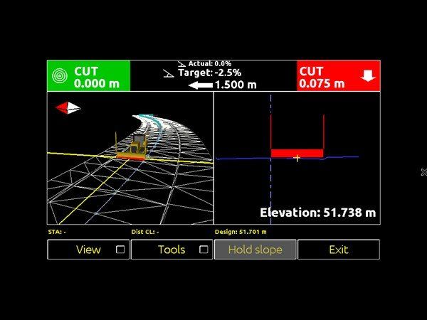
I can create models for digging foundations, drainage runs, batters, ponds, duct crossings, roads - reduced level dig, filling and trimming - if you can dig it, grade it, trim it I can model it!!! 

I can also create exclusion zones so the operator knows when he's getting too close to something he shouldn't be.


 Restraint kerb dig out
leica amchine control kerb dig

This shows Ian in the 225 digging for the kerblines on a new 500 space car park at Goodwood. Some were 100m long. The detail here meant a dig of 580 below finished road level to allow for a 305x150 kerb which acted as restraint for a permable parking bay. I created the kerb line model which enabled Ian to dig out a strip  with a 600 bucket then I could follow and pin up for kerbs.


Road formation level dig and stoning up
pennefathers road reduced level dig with topcon 3dmc on careys 225

This shows our 225 machine fitted with gps machine contol digging out for pennefathers road at Aldershot. We trialed the leica icon 3d and topcon 3dmc systems. This was great for me as I learned how to created the model for both systems. We used it for reduced level dig, service crossings and filling and grading stone - 900m of road with no profiles.


I have the software to first of all create the 3d digital terrain model, then to create files each system can read. I also have simulators for the Leica & Topcon systems so I can check the models work and remove any bad data before uploading to the operators control box.

leica icon 3d mc at corunna aldershot coopergeomatis
coopergeomatics leica icon 3d simulation

Drainage 
leica icon 3d sreen in drivers cab

This shows the view from the drivers cab.  We are using the leica icon 3d gps to dig the drainage trench. The screen shows the drainage model which I created.


Files for machine control

This is the leica icon machine control panel. I dont need to be able to drive the machine or install the hardware, but I can create the models and files required for it to work and upload to the control box. I can advise the driver on the operation the control box and resolve issues to do with common error messages. Also working with the machine driver  to reduce clutter on the screen, minimising info and colouring layers to the drivers' preference. I understand that ultimately its the driver who is the key to this working. This is the model I did for Corunna Roads  at Aldershot


Leica Icon 3d Emulator

By trying out the machine control files on the Icon 3d emulator I can check the files work, have no bad data in and more importantly will work when I put in the system in the operators cab. This image shows a drainage run that we will be doing shortly
Leica Icon 3d Emulator
 
This image shows the simulation of a duct crossing that we are about to do - yep that works!

Leica Icon 3d emulator
Here I can check to see if the data is sound
triangle check
data check

Avoidance Zones

The images below show a drainage run we did at Aldershot. There was a live gas pipe 2m away from where we were digging. By doing trial holes and recording the gas pipe's location I could accurately model the gas pipe and create an exclusion zone around it. If the operator puts the bucket in this zone there is an audible and visual alarm to alert the operator. By using the simulator I can make sure the models work before uploading to machine.
avoidance zone alert
3d view of dig v avoidance zone
plan view of avoidance zone

Topcon 3dmc
topcon 3dmc simulation

I am now able to produce files for Topcon machines. By using a combination of LSS, Topcon 3d office and the 3dmc simulator I can create, check and make sure the data is sound. The image adjacent shows the 3dmc simulation of the control box which is the same as what the operator has in the digger.


Foundation model

These images show the 3d model for foundations dig out for a steel framed building and the Leica Icon 3d machine control file of the same foundations
pad foundations dig using leica

Simulation of ditch excavation
leica icon topcon 3dmc ditch simulation

We had a ditch to dig at Aldershot,  I created this model to do the job. Unbeknown to me Micks machine and the Leica gps was to be off hired soon after so we never used it. I was curious to see the difference between topcon and leica.  The image on the left is made using Topcon 3dmc and the image on the right is from Leica Icon 3d emulator


Check for anomolies

Here we can see an example of some "bad" data that by running the simulation can be corrected before the model is loaded onto the machine. It only needs 1 point to be out to create blade wobble!!
check for bad data

3d simulation of channel design

This is the 3d design model for a channel that was dug through Portsmouth Golf Course as part of the 4d flood alleviation scheme